
3D Laser Scanning Services for Your Industry

MYND Workshop’s 3D Laser Scanning & Reality Capture services provide cutting-edge solutions for multiple industries, including AEC, Historic Preservation projects, and creative fields, leveraging advanced technology to capture detailed and accurate digital representations of physical spaces and objects. Whether optimizing architectural design processes, conserving historical artifacts, or enhancing visual effects, our precision scans deliver unparalleled value across diverse applications.Our Core 3D Scanning & Reality Capture Services
-

3D Laser Scanning
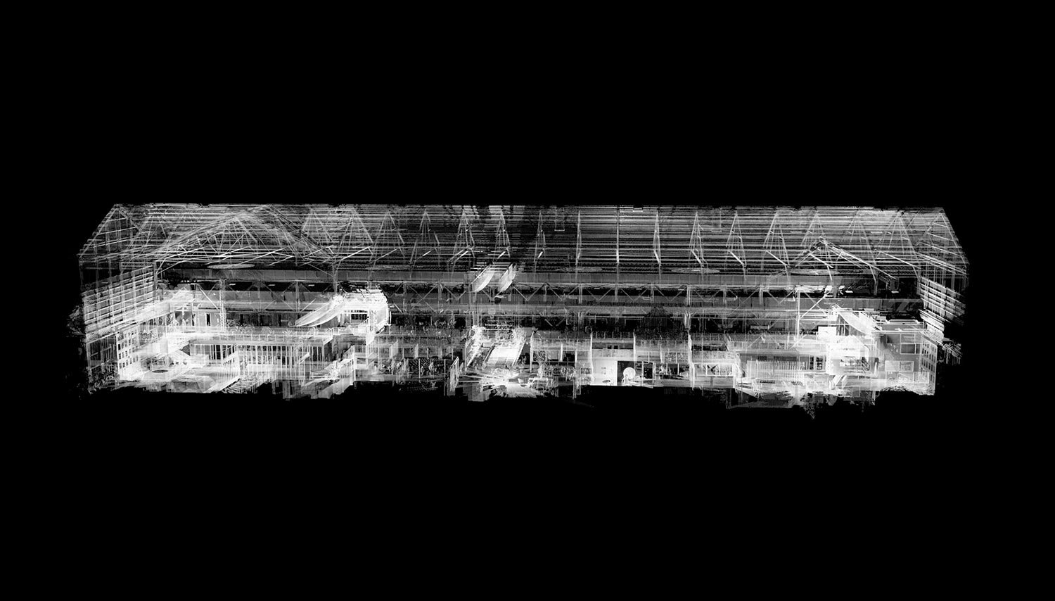
We capture high-precision 3D point clouds using LiDAR scanning, delivering accurate spatial data for architecture, engineering, construction, and preservation.
-

As Built Surveys
Our as built drawings provide detailed CAD and BIM-ready floor plans, elevations, and sections, ensuring accurate documentation for renovations and facility management.
-

Scan to BIM
We convert point cloud data into Revit BIM models, allowing seamless integration of existing conditions into digital workflows for design, planning, and construction.
-

Drone Survey Services
Using aerial LiDAR and photogrammetry, we produce orthophotos, topographic maps, and facade inspections, improving site analysis, land surveys, and real estate visualization.
-

Digital Twins
We create high-fidelity digital twins—interactive, data-rich 3D models that enhance facility management, industrial monitoring, and virtual asset tracking.
-

Decorative Finishes Scanning
We capture high-resolution 3D scans of fine art, murals, and architectural ornamentation, aiding conservation, restoration, and replica fabrication.
-

Environment & Locations Scanning
Our 3D environment scanning provides VFX, gaming, and virtual production teams with real-world digital backlots, HDRI imagery, and CGI-ready locations.
-

Scan Meshing & 3D Modeling
We refine raw scan data into optimized 3D meshes, offering retopology, UV mapping, and NURBs modeling for fabrication, animation, and digital assets.
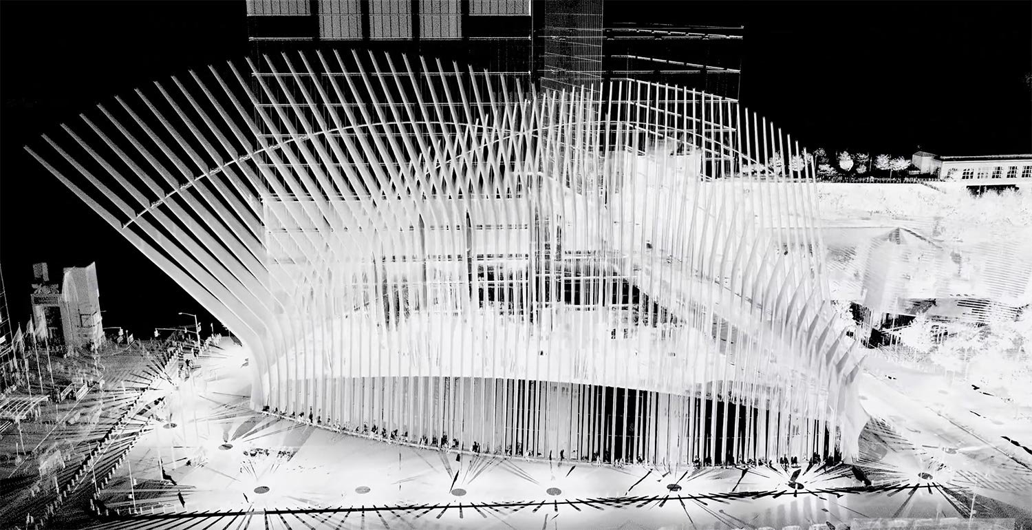
1/6Our 3D scanning and reality capture services provide architects, engineers, and construction professionals with high-accuracy digital documentation, as built data, and BIM integration. Using LiDAR scanning, photogrammetry, and drone-based surveys, we create detailed 3D models, floor plans, and digital twins that enhance planning, design validation, and project coordination, ensuring efficiency from concept to completion.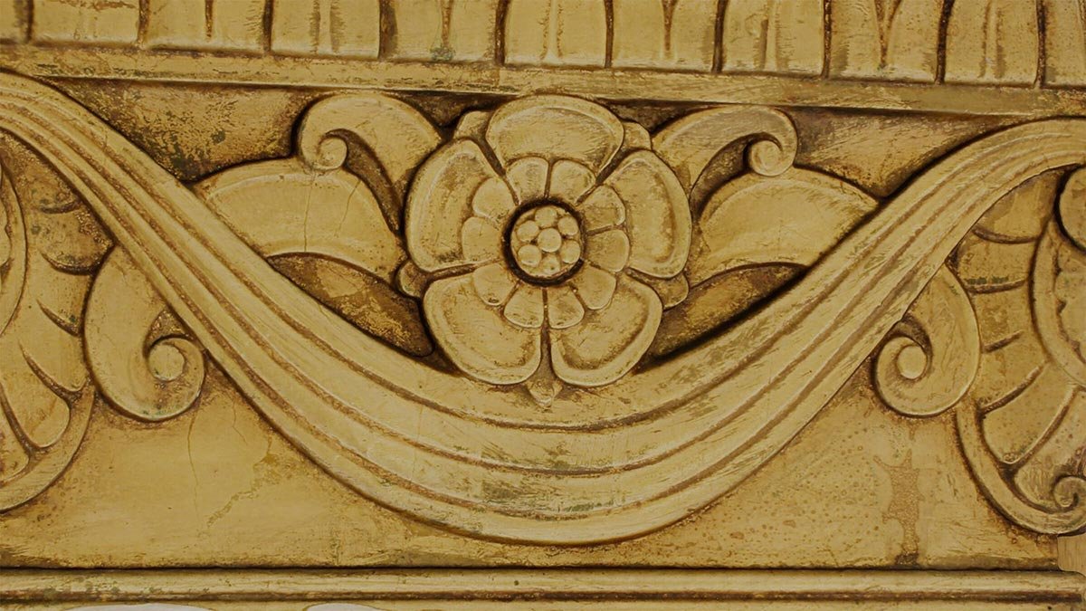
2/6We specialize in high-resolution 3D scanning for historic preservation, capturing architectural details, sculptures, and murals with sub-millimeter precision. Our LiDAR scanning, photogrammetry, and orthophoto documentation create digital records for conservation, restoration, and archival purposes, safeguarding cultural heritage and historic sites for future generations.
3/6Our 3D scanning services support VFX, gaming, and virtual production, providing digital backlots, high-resolution environment scans, and CGI-ready assets. Using LiDAR, photogrammetry, and HDRI imagery, we deliver real-world 3D environments, detailed object captures, and optimized models for seamless integration into film, animation, and interactive experiences.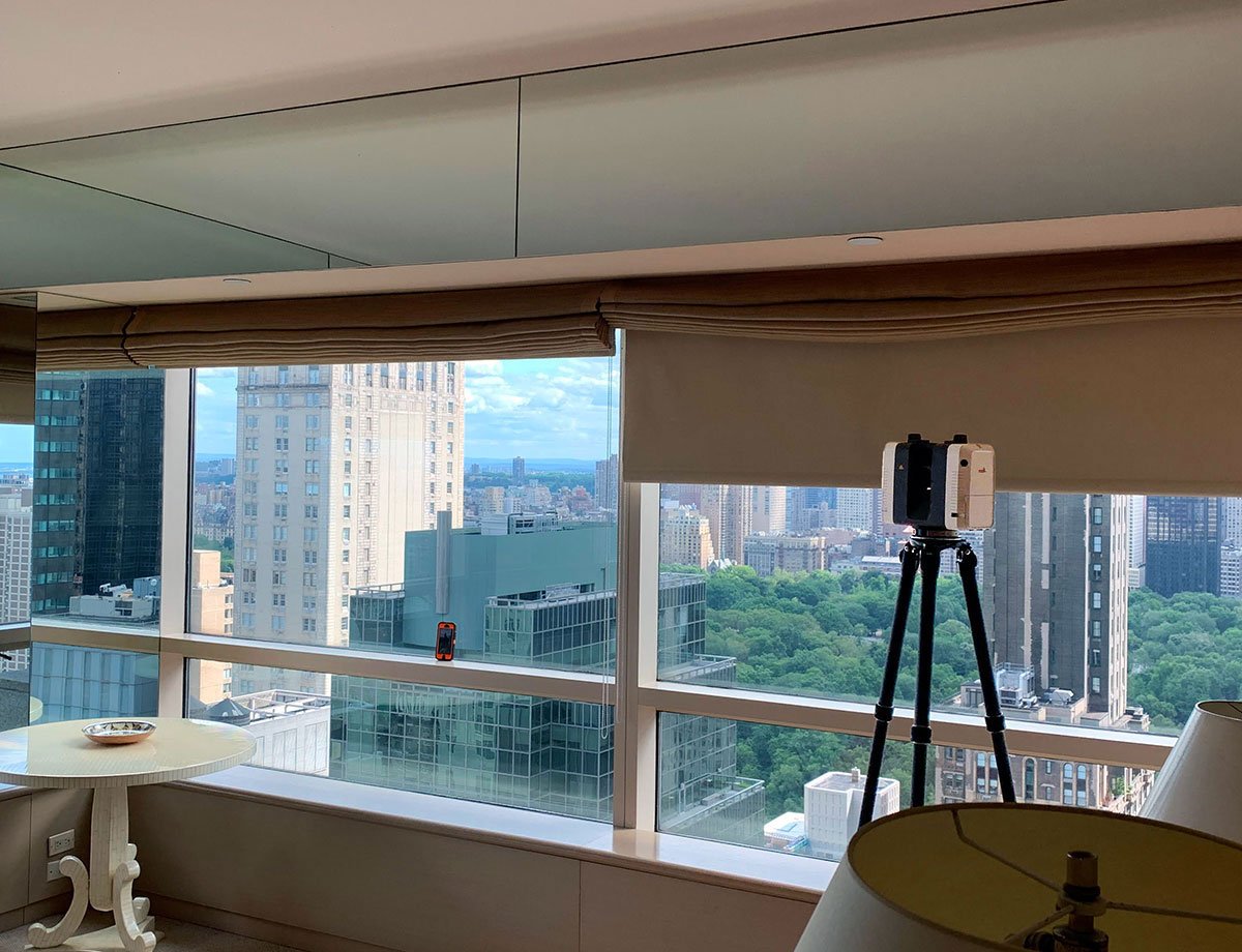
4/6We provide high-precision 3D scanning and as built documentation for real estate developers, property managers, and homeowners, offering floor plans, digital twins, and virtual walkthroughs. Our drone surveys, LiDAR scanning, and photogrammetry enhance marketing, property analysis, and renovation planning, delivering accurate and interactive property documentation.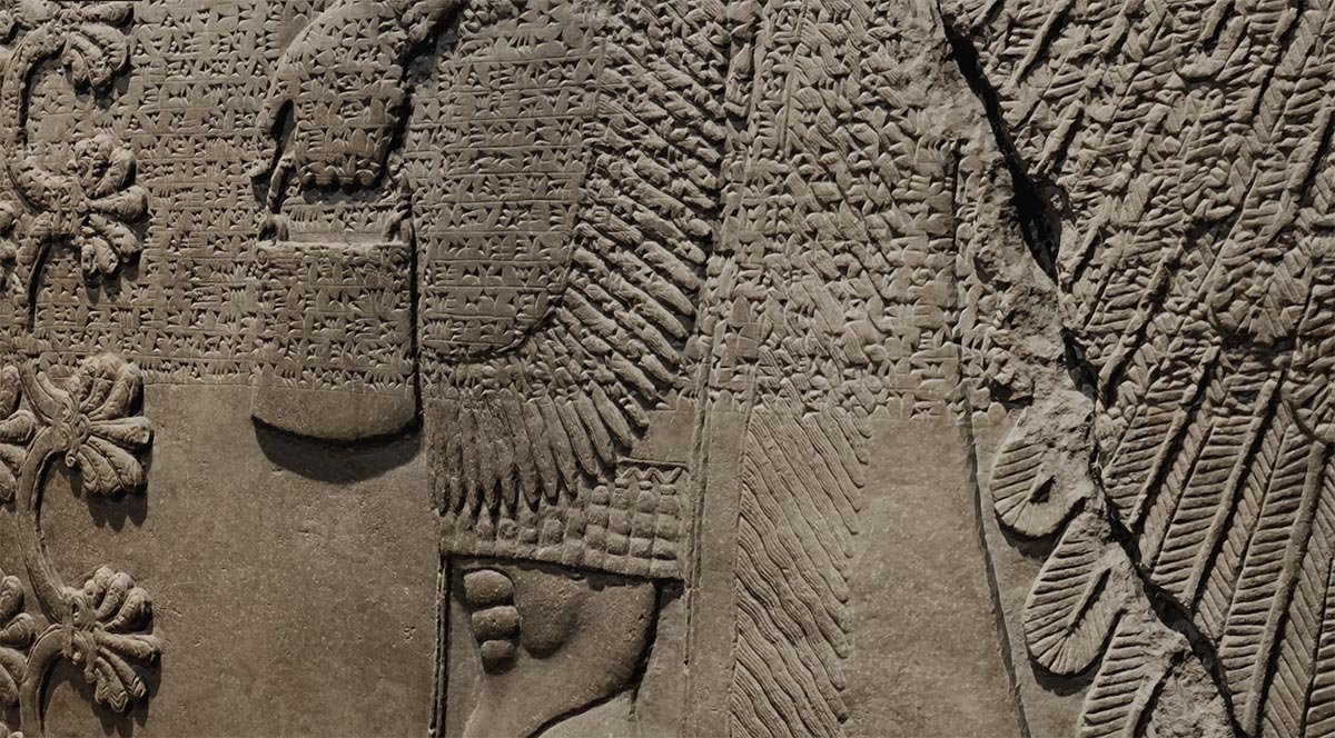
5/6Our museum and heritage scanning services preserve artifacts, sculptures, and historic interiors with high-resolution 3D modeling and surface texture capture. We provide digital archives, interactive exhibits, and detailed restoration references, ensuring accurate documentation and accessibility for cultural institutions, researchers, and conservators.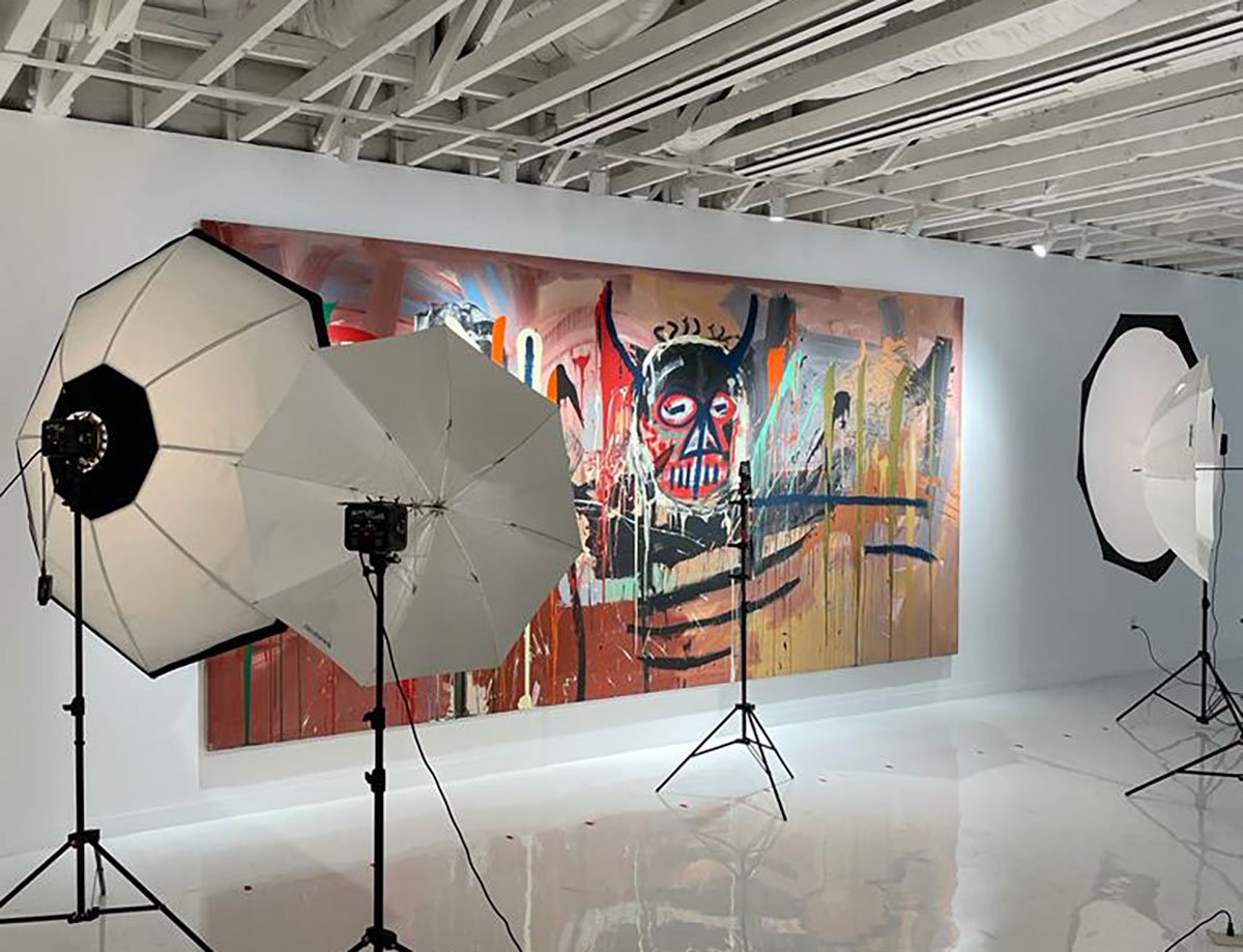
6/6We offer precise 3D scanning and modeling for artists, fabricators, and custom manufacturers, delivering detailed object scans, digital sculpting, and optimized meshes. Our LiDAR scanning, photogrammetry, and high-fidelity 3D printing preparation enable accurate replication, digital restoration, and fabrication-ready CAD models for creative and industrial applications.What our customers are saying
-
They always took the time to understand and meet our technical standards, which made them a dependable partner. Their professionalism and precision made them an easy team to trust, and I’ve continued to work with them since—most recently on a Call of Duty title while at Treyarch. MYND Workshop has become a go-to resource for scanning, and I look forward to continuing our collaboration in the future.
⭐⭐⭐⭐⭐ Guilherme Rambelli, Treyarch / Call of Duty
-
It is great working with this team. They are prompt and easy to communicate with. Their work product is clean and they always go the extra mile to make sure all is correct and ready.
⭐⭐⭐⭐⭐ Michael Bednark, Bednark Studio Inc.
-
The team at MYND came prepared and reacted in the best possible way to every change thrown at them. They were patient, understanding, technically proficient, and communicated well throughout the entire process from the planning stages to the final deliverables. Michael and Dallas of MYND were great to work with and I recommend their services to anyone needing laser scanning.
⭐⭐⭐⭐⭐ Justin Britton, Avail Infrastructure Solutions
-
I have worked with MYND and team for a few years now on several different projects. They have been very professional and flexible with scheduling our on site scans. They are willing to travel which definitely helps out my team. Their pricing was up front and fair, and their scans and output documentation has been on point and worked great for my team. MYND is my first call when it comes to site scanning for my projects.
⭐⭐⭐⭐⭐ Donald Day, Metrica, Inc. Superyacht & Luxury Residential