

Reality Capture Services for A.E.C.
Reality Capture & 3D Scanning Services for Architecture, Engineering & Construction
Architects
//
Civil Engineers
//
Structural Engineers
//
Mechanical Engineers
//
Electrical Engineers
//
Construction Managers
//
Building Contractors
//
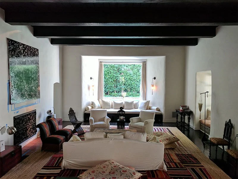
Interior Designers
//
Urban Planners
//
Landscape Architects
//
Real Estate Developers
//
Architects // Civil Engineers // Structural Engineers // Mechanical Engineers // Electrical Engineers // Construction Managers // Building Contractors // Interior Designers // Urban Planners // Landscape Architects // Real Estate Developers //
MYND Workshop's 3D laser scanning services are revolutionizing the AEC industry by providing unparalleled precision in as-built surveys and BIM modeling. Our state-of-the-art technology accurately captures every detail of structures and spaces, turning them into detailed digital models. This capability is not just limited to building structures; our drone surveying and orthophoto services extend the potential of spatial analysis to new heights.

Our comprehensive approach to 3D laser scanning also encompasses specialized services like Scan to BIM modeling, MEP Documentation and Concrete Scanning. Each service, including as-built drawings creation, is designed to meet the diverse needs of AEC professionals, ensuring every project benefits from the highest level of accuracy and detail.
Our AEC work frequently involves large, occupied, or operationally sensitive environments — from civic and institutional buildings to active airport and aviation facilities — where reliable documentation is critical to downstream coordination.
Our Reality Capture Services for A.E.C.
-

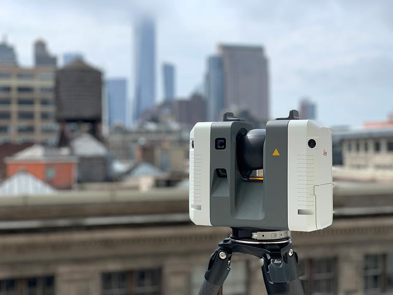
3D Laser Scanning
We provide precise 3D laser scanning services to capture detailed measurements and point clouds of structures, objects, and environments for accurate documentation and analysis.
-

As Built Surveys
Our as-built drawings services deliver detailed 2D and 3D documentation, ensuring precise records of construction projects for compliance, future planning, and design integration.
-

Scan to BIM
Our scan-to-BIM services transform laser scan data into detailed Building Information Models, supporting accurate planning, design, and construction workflows.
-

Drone Survey Services
We use advanced drone technology for photogrammetry, LiDAR, roof and facade inspections, and terrain mapping, providing high-precision data for diverse applications.
-

Digital Twins
We specialize in 3D digitization and digital twin creation, offering photogrammetry, object scanning, and digital documentation for 3D printing, fabrication, and archiving.
-

Decorative Finishes Scanning
Our fine art scanning services provide high-resolution, accurate digital archiving for valuable paintings, sculptures, and artifacts, ensuring preservation and detailed reproduction.
-

Environment & Locations Scanning
We capture detailed point clouds, 3D models, and reference imagery of environments and locations, offering texture photography, HDRIs, and virtual tours for comprehensive documentation.
-

Scan Meshing & 3D Modeling
Our scan meshing and 3D modeling services transform point cloud data into specialized meshes, NURBs models, and UV-mapped assets, tailored for design, analysis, or fabrication.


AEC Trusts MYND.
MYND Workshop is renowned for our collaborations with high-profile clients in the AEC industry, cementing our reputation for excellence and innovation. Our portfolio, highlighted by successful partnerships, exemplifies why AEC trusts MYND for their 3D laser scanning needs. Our commitment to precision and quality has made us a preferred choice among industry leaders.
Select Applications & Use Cases for A.E.C.
-

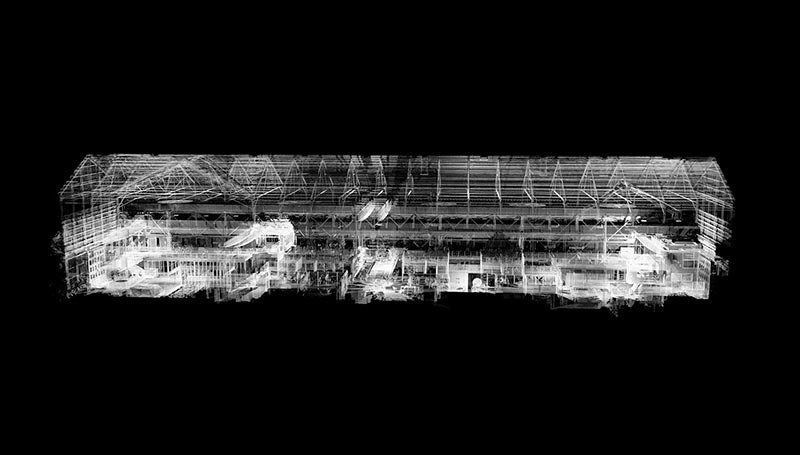
3D Point Clouds
We deliver highly accurate, colorized 3D point clouds in various formats with precision down to 1mm, providing detailed data for design, analysis, and construction workflows.
-

CAD Backgrounds
Our CAD backgrounds include floor plans, sections, elevations and more, offering seamless integration into design software for accurate planning and project development.
-

3D As Builts for Clash Detection
Our 3D as-builts are optimized for clash detection in software like Navisworks, ensuring seamless coordination and conflict resolution for complex construction projects.
-

MEP Systems Documentation
We provide precise documentation of MEP systems, capturing mechanical, electrical, and plumbing layouts to streamline design, retrofits, and system integration.
-

Concrete Scanning
Our surface scanning services analyze concrete, floor flatness & levelness, and surface deviation, offering detailed heat maps and elevation data for quality assurance and control.
-

Roof & Facade Inspections
Using drones and terrestrial photogrammetry, we conduct roof and facade inspections, capturing high-quality imagery, videos, and orthophotos for comprehensive analysis and maintenance planning.
-

Orthographic Imagery
We produce quick and cost-effective orthographic imagery, generating detailed floor plans, facade elevations, sections, and roof plans directly from point cloud data.
-

Virtual Walkthroughs & 3D Visualization
Our virtual walkthroughs use 360-degree spherical imagery and 3D meshes, providing immersive visualization and accurate bases for renderings and project presentations.
Servicing Locations Across the U.S.A.
With 10 strategic hubs across the United States, MYND Workshop's Reality Capture & 3D Scanning services are more accessible than ever, especially to our clients on the East and West Coasts. Our central hub in Dallas further enhances our reach, ensuring we can efficiently serve clients nationwide and even internationally, without compromising on our commitment to quality and precision.


Frequently Asked Questions
-
3D scanning provides high-accuracy as built documentation, BIM-ready models, and digital twins, improving design validation, clash detection, and construction planning while reducing costly errors.
-
Yes! We deliver precise point clouds and Revit-compatible models, allowing seamless integration into BIM software for renovations, retrofits, and new construction projects.
-
By capturing high-resolution 3D scans of site conditions, we help teams track progress, detect deviations, and ensure compliance with design specifications.
-
We scan commercial buildings, infrastructure, industrial sites, and residential properties, producing CAD and BIM-ready documentation for accurate planning and design.
-
Yes! Our as built services include floor plans, elevations, and sections, ensuring accurate documentation for design modifications and compliance requirements.
-
While 3D laser scanning captures interiors and complex structures in detail, drone photogrammetry provides aerial mapping for site analysis and terrain modeling, supporting comprehensive project planning.