
Terrestrial LiDAR Scanning for Airports & Aviation Facilities
Accurate documentation for active, security-sensitive environments
Airports and aviation facilities present some of the most demanding conditions for reality capture. Live operations, strict security protocols, tight access windows, and complex building systems leave little room for error.
MYND Workshop specializes in terrestrial LiDAR scanning and 3D documentation for active airport environments, delivering reliable, high-accuracy data while minimizing disruption to daily operations. Our work supports planning, renovation, coordination, and visualization across terminals, support buildings, and airside-adjacent facilities.

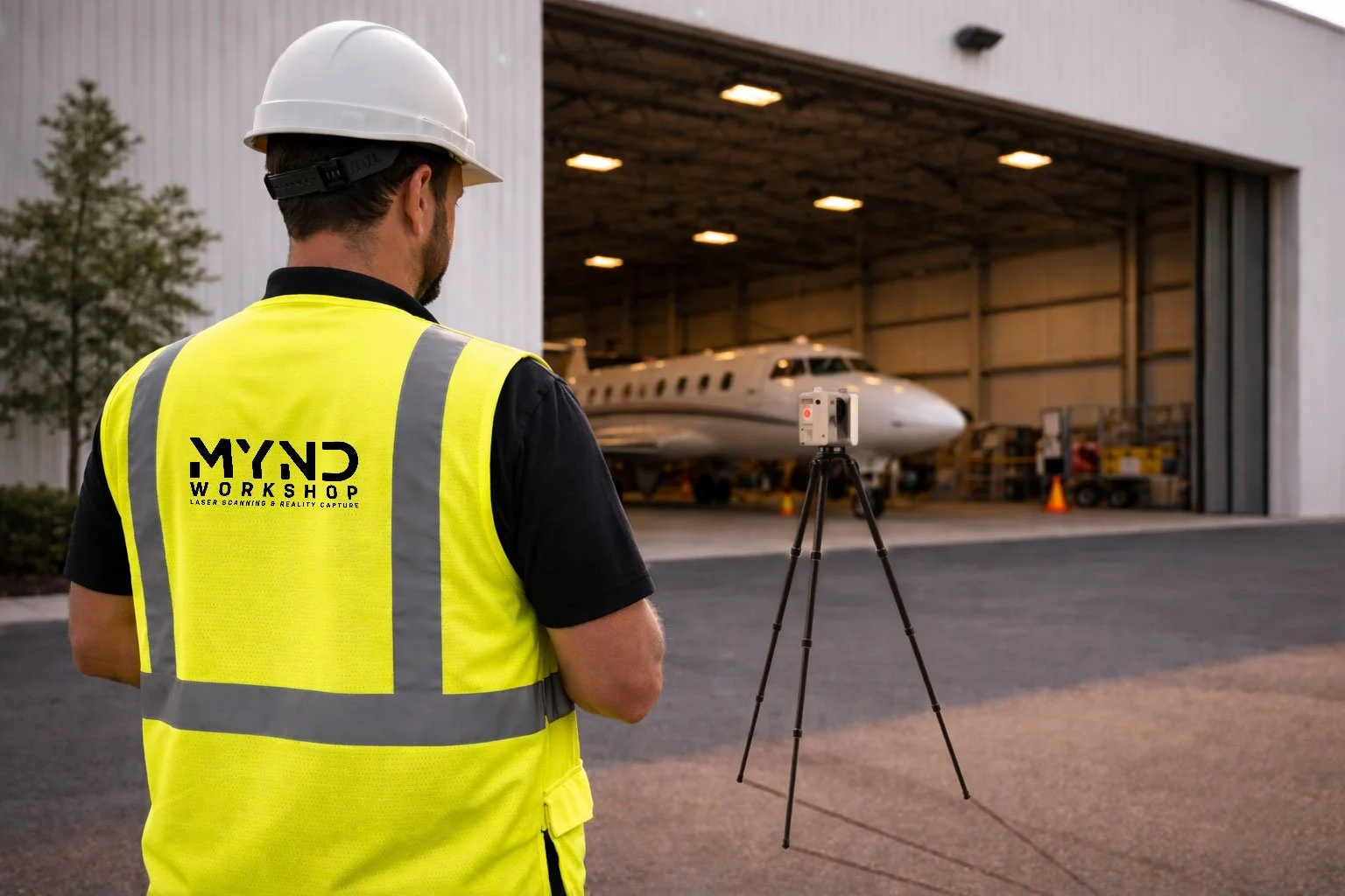
Scanning a hangar at regional airport in the Northeast U.S.
Working within real operational constraints
Aviation projects are rarely “clean slate” environments. Successful documentation requires experience operating within real-world constraints, including:
Live passenger circulation and occupied spaces
Restricted access zones and security requirements
Night work and limited access windows
Tight coordination with owners, consultants, and facility teams
Complex MEP systems and layered renovations over time
Our approach is designed to integrate seamlessly into these conditions, ensuring that capture is completed efficiently, safely, and without compromising accuracy.
Proven experience in airport and aviation settings
MYND Workshop has supported documentation efforts for numerous aviation facilities, most recently including campus-wide Scan to BIM documentation of Westchester County Airport, as well as targeted scanning work at John F. Kennedy International Airport (JFK). These projects have ranged from interior terminal areas and back-of-house spaces to infrastructure and support zones requiring precise spatial understanding.
While each airport presents unique challenges, our focus remains the same: delivering dependable, high-accuracy data that downstream teams can trust.
Deliverables tailored to project needs
Rather than producing generic datasets, we focus on outputs that directly support decision-making and coordination, including:
Registered terrestrial LiDAR point clouds
Existing conditions documentation for renovation and retrofit projects
Scan-to-BIM models aligned with project scope and level of detail
2D plans, sections, and elevations derived from 3D data
Data optimized for design coordination, construction planning, and visualization
All deliverables are scoped to align with how the data will actually be used — whether for design development, clash coordination, or long-term facility documentation.
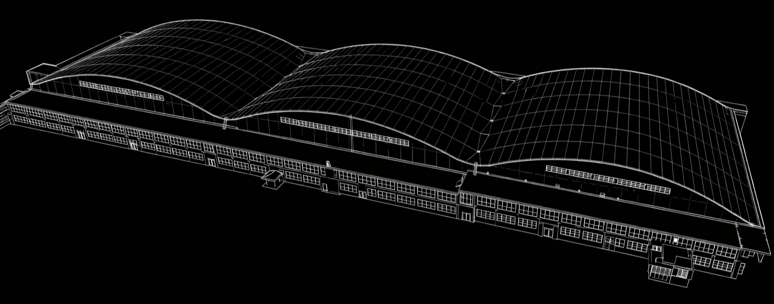
Visualization of 3D Revit Model of Airplane Hangar Exterior
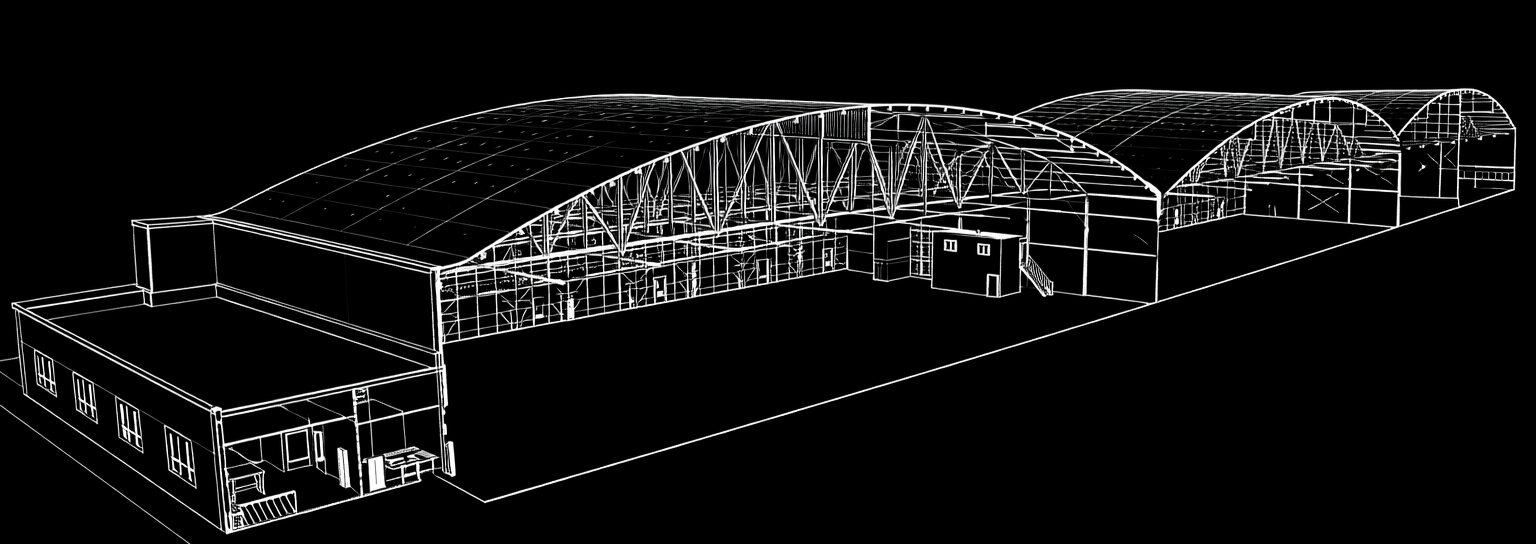
Section Cut through 3D Revit Model of Airplane Hangar Exterior
Why accuracy matters in aviation environments
In airport projects, inaccurate or incomplete documentation can lead to:
Costly redesigns
Scheduling delays
Access conflicts during construction
Increased risk in already complex environments
High-quality reality capture reduces uncertainty early, helping teams plan confidently and avoid downstream issues.
Early coordination makes the difference
Airport and aviation documentation benefits greatly from early discussion around access, security, and operational constraints. We regularly collaborate with owners, architects, engineers, and contractors to define an efficient capture strategy before work begins.
If you’re planning work in an active airport or aviation facility, we’re happy to discuss documentation needs and access considerations early in the process.